Starfire Minerals Inc.
Langmuir Property, Ontario
Langmuir Property map
Pdf (229.kbs)
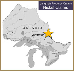 The Langmuir South property consists of four contiguous unpatented claims comprising 17 units covering a nominal 272 hectares in Langmuir Township, Porcupine Mining Division, 30 km southeast of Timmins, Ontario. The property overlies part of a komatiitic volcanic sequence that flanks the Shaw Dome, where historic production plus reported resources (not 43-101 compliant) from the Alexo, Dundonald South, Hart, Langmuir, Langmuir North, Langmuir South, McWatters, Redstone and Texmont properties approximate 9.1 million tonnes averaging 1.47% Ni.
The claims are 100% owned by Starfire Minerals Inc. subject to a 2% net smelter return royalty.
The Langmuir #2 shaft lies immediately north of the Property; the South Zone of the Langmuir #2 deposit strikes west-southwest onto Starfire's property. The Langmuir #2 shaft produced 1,113,750 tonnes averaging 1.45% Ni during the period 1972 to 1978. A historical inferred resource (not 43-101 compliant) of about 181,400 tonnes grading 1.55 Ni is thought to remain in the South Zone. It is estimated that approximately 100,000 tonnes of this historical resource resides on the Starfire property (Harron, 2006). The Company's objective is to explore the extensions of the South Zone of the Langmuir South Property via diamond drilling.